
Services


Cartography, GIS and Remote Sensing
-
Creation of thematic maps
-
Creation and processing of geospatial layers
-
Spatial analysis with GIS
-
Integration of geographic and satellite data

Hydrological Modeling and Watershed Management
-
Delineation and analysis of river basins
-
Hydrological modeling with SWAT and others
-
Runoff and flow assessment
-
Water erosion analysis
-
Sustainable water resource management
-
Inventory of Water Resources
-
Water Quality

Ecology and Climate Change
-
Deforestation analysis
-
Land cover and land use analysis
-
Calculation of climate anomalies under climate change scenarios
-
Climate variability analysis
-
Ecosystem and biodiversity assessment
Territorial and Social Vulnerability
-
Identification and mapping of risk zones
-
Spatial analysis for disaster management
-
Design and development of open and semi-structured surveys
-
Analysis of socioeconomic and environmental information
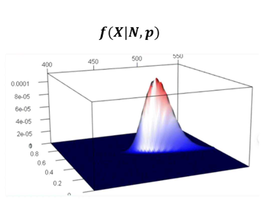
Statistics and Modeling
-
Statistical data analysis
-
Data modeling
-
Data visualization and exploration
-
Database creation
-
Spatial data processing
-
Creation of automated tools and applications
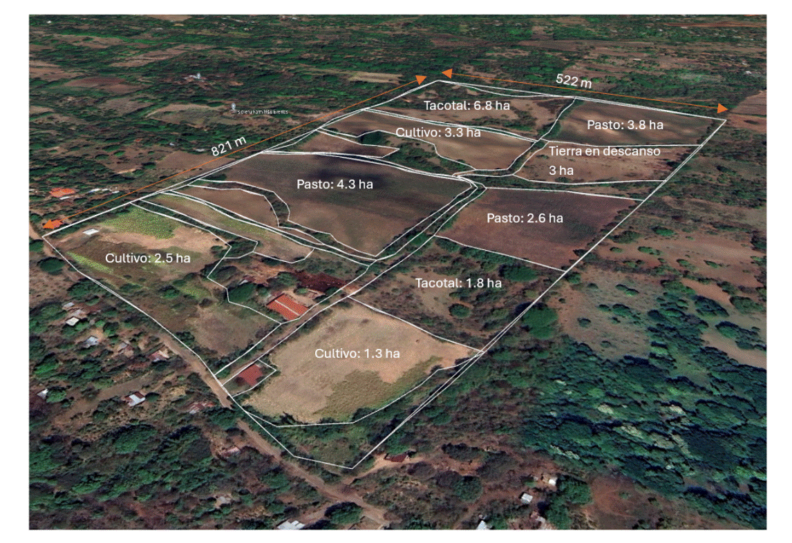
Agro SIG
-
Agricultural suitability maps
-
Vegetation indices (NDVI) to assess crop health
-
Water stress and soil moisture analysis
-
Identification of low productivity areas within the farm
-
Monitoring vegetation cover
Training
-
ArcGIS / QGIS courses for spatial analysis and mapping
-
Introduction to hydrological modeling
-
Satellite image processing
-
GIS workshops for environmental projects

Portfolio
This portfolio presents a selection of projects developed by SpatiaMap, as well as projects in which its founders have participated within the framework of their previous professional experiences.


Watershed Management
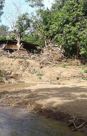
Water Harvesting Structures and Their Influence on Hydrological Variables in a Small Watershed in Corredor Seco of Nicaragua, Hydrological Modeling with SWAT

Deforestation
Analysis of the causes of deforestation and forest degradation in Nicaragua
Hydrological modeling and soil erosion
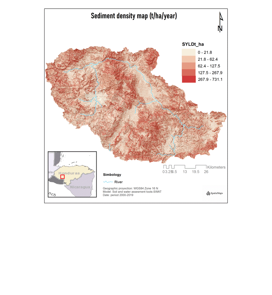
Watershed Delineation and Analysis of Hydrological Variables in Honduras: Water Erosion, Runoff, and Streamflow
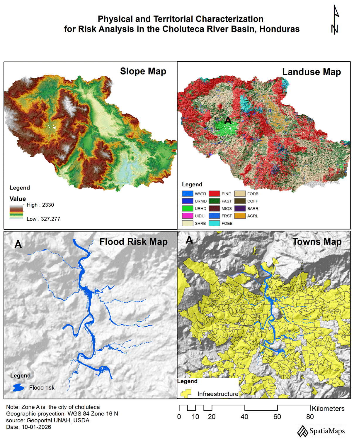
Natural disasters and territorial vulnerability
Multi-Hazard Mapping for Flood and Landslide Response Planning in Rivas, Nicaragua

Agro SIG
-
Property delimitation,
-
Land use, conflict, and erosion
-
Stress zones,
-
Plant health and biomass density
Ecology and Climate Change
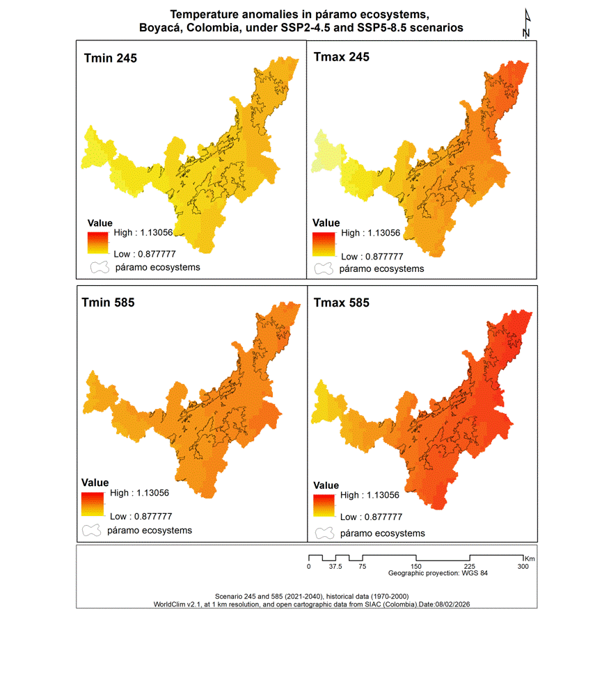
Calculation of climate anomalies on páramo ecosystems in Boyacá, Colombia
Protected Areas and Land Use Planning
Geospatial delimitation of protected areas integrating environmental, territorial and regulatory criteria as support for territorial
Others Projects:
-
Preparation of an inventory of water resources, seasonality, and water quality for an initial diagnostic.
-
Municipal land-use planning (PMOT) and master urban development plan (PMDU) with a focus on climate change adaptation (CCA) and integrated disaster risk management (IDRM) for the municipality of the Central District, Honduras.
-
.....
Academic and Training Lectures:
-
GIS trainer at universities in Latin America
-
Member of thesis juries (undergraduate and postgraduate)
-
Technical training for public officials and independent professionals
-
.....
Full Portfolio
To respect confidentiality agreements and intellectual property rights, some maps and images featured here are illustrative reconstructions created by SpatiaMap to demonstrate our methodology and results.
Safety and guarantee
Data protection
-
Secure management under customized protection protocols
Guarantees
-
Commitment to quality and support at every stage
Signature
-
Signing process tailored to your convenience.
Confidentiality
-
Absolute confidentiality and discreet handling of information
Advantages
-
High-quality service at a competitive price
-
First consultation and quote free of charge.
About us
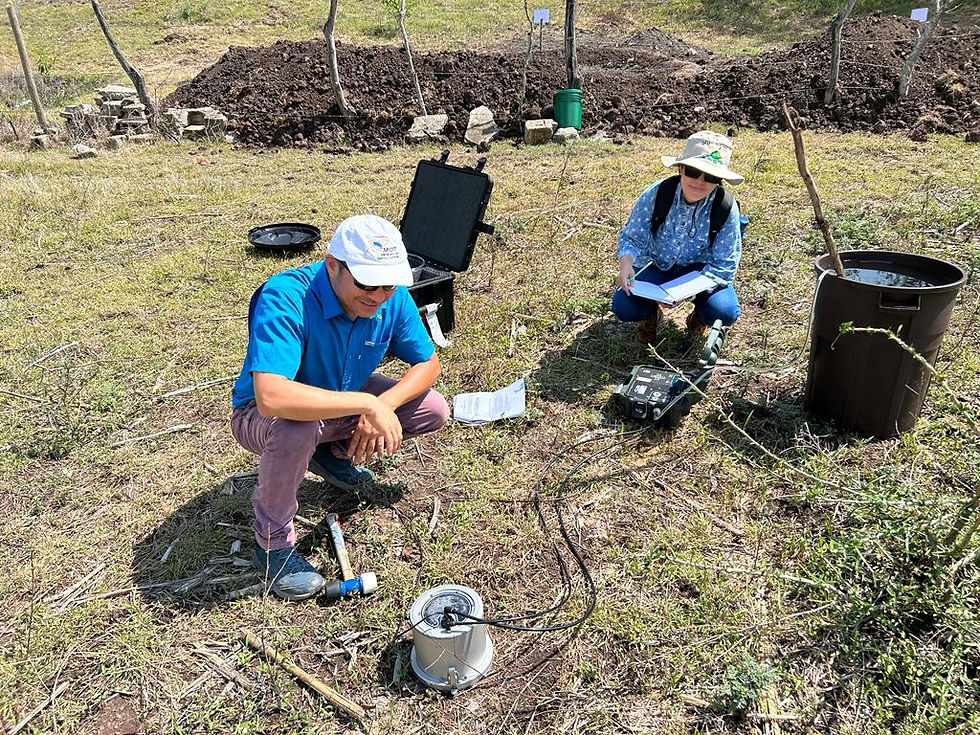
At SpatiaMap, we believe that the territory tells a story, and our work is to translate it into actionable data. We are a multidisciplinary team with a global perspective on current challenges, working on projects in geomatics, hydrology, environmental science, agriculture, and climate change.
Our Leadership
-
A. Matus, Co-founder: MSc. in Integrated Watershed Management. An expert in GIS and Hydrology, she brings a scientific perspective supported by various publications and projects on water management and climate change throughout the region.
-
N. Grossoleil, Co-founder: Agricultural Engineer with a Master's degree in data analysis. He brings the rigor of the French engineering school, specializing in the processing of complex data and applied modeling.
Collaborative and Strategic Approach
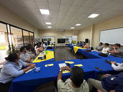
We don't work alone. At SpatiaMap, we enhance our capabilities through a strategic network of specialized consultants who join the team according to the technical and thematic requirements of each challenge. This flexible structure allows us to offer robust, ethical consulting services that are deeply connected to the realities of the environment.
 |  |  |  |
|---|---|---|---|
 |
Gallery
Contact us
Get advice, quotes and solutions for your innovative projects.
Phone
+50588329424